An Icy Farewell
March 13, 2024

The Arctic
Revealed

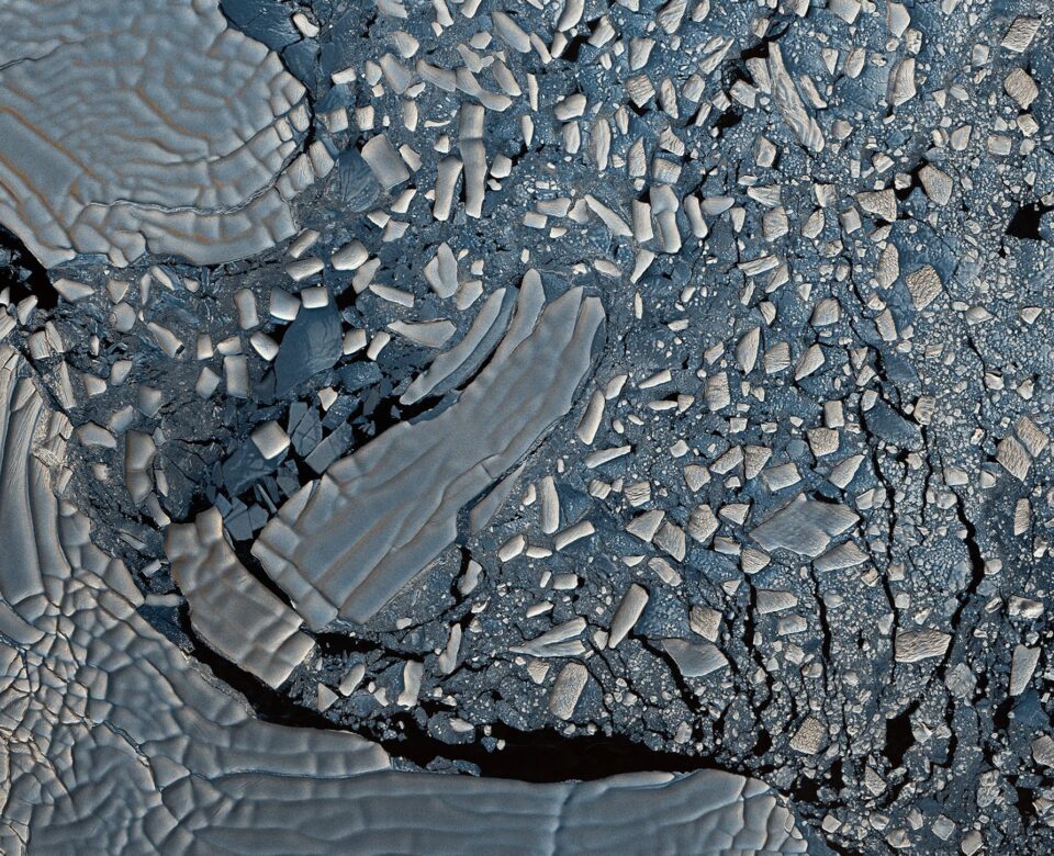
Sea ice off the east coast of Greenland

In this image captured by the Copernicus satellite Sentinel-2, small pieces of sea ice, known as ice floes, trace out the ocean currents beneath, resulting in a large swirl-like feature of approximately 120 km in diameter off the east coast of Greenland.

© Sentinel-2, Copernicus, ESA

ICE

Arctic sea ice is the frozen layer of the Arctic Ocean that reflects sunlight and regulates heat exchange. It has shrunk by 12.2% per decade since 1979, reaching its second lowest extent in 2021. Satellites track sea ice changes, such as extent, age, and thickness, and their effects on wildlife, human activities, and weather patterns.

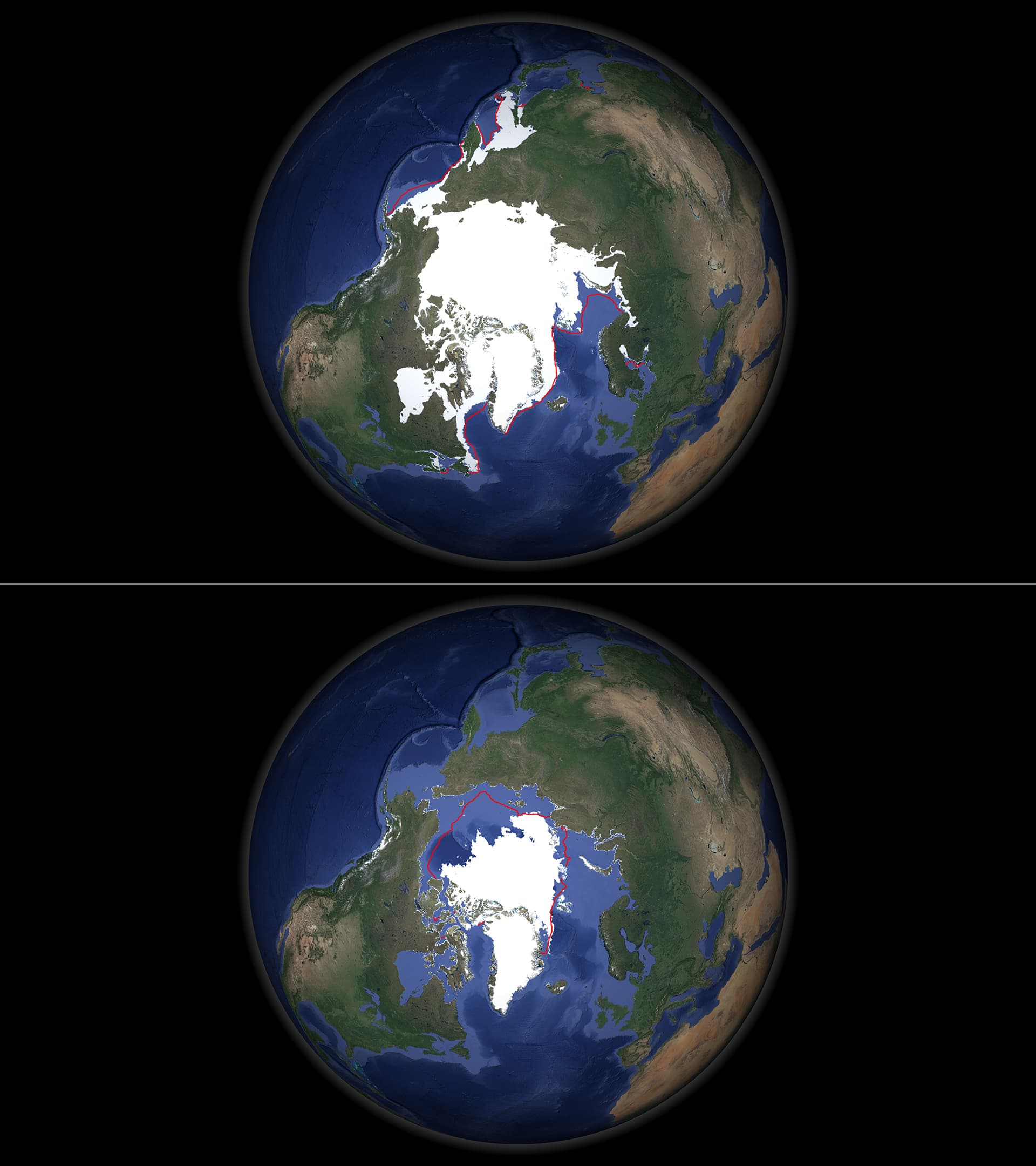
This polar view map shows the 2023 minimum and maximum sea-ice extent. The annual minimum was reached after summer on 19 September 2023. The maximum extent was reached on 06 March 2023. The red lines show the equivalent 1981-2010 median sea-ice extents.

© ESA

Paolo Cipollini

Ocean and Ice Senior Scientist

European Space Agency - ESA
Sea ice is very important as it is an ecosystem for many different life forms. It also plays a crucial role in climate regulation. Because sea ice is bright, when it melts, it exposes the darker ocean beneath. The bright sea ice reflects back a vast amount of energy from the sun. When the ice melts, this energy is absorbed by the sea, making global warming worse. This is why satellite monitoring of sea ice is necessary to assess its extent and depth, so that predictions can be made. Human activity and shipping in the polar regions also needs to be monitored.
Other Stories